
Missouri Ride Maps - Page 3


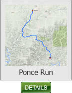
This 35 mile ride is a fun one with lots of twisties and a run along the James
River, and through the little village of Ponce De Leon.
Ponce Run - 35 miles (Missouri)
This 43 mile ride take you from Urbana (Hwy 65) to Lebanon via a rural
backroad County road T and past Bennett Springs State Park to Lebanon.
Urbana to Lebanon - 43 miles (Missouri)
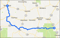
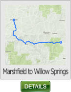
This 86 mile ride begins in Marshfield and take a less traveled road to the
community of Willow Springs.
Marshfield to Willow Springs - 86 miles (Missouri)
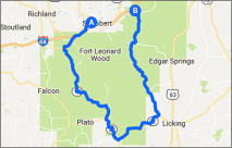
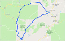
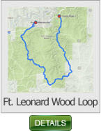
This 81 mile ride loops the U.S. Army Base Ft. Leonard Wood, via Hwy 17 &
Missouri J. A scenic rural ride with lots of twisties.
Ft. Leonard Wood Loop - 81 miles (Missouri)
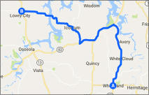
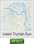
This 37 mile ride takes you from Lowery City off Hwy 13 to Wheatland at Hwy
54. You’ll travel some of the most beautiful back roads the Northern Ozarks
has to offer. Don't forget to stop by the general store in Iconium for a great
lunch.
Lower Truman Run - 37 miles (Missouri)
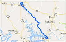
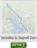
This 25 mile ride takes you from the north side of Versailles to the Bagnell
Dam. It has lots of long sweepers and curves to satisfy most every riding
style, and the vistas are some of the best in the Northern Ozarks region.
Versailles to Bagnall Dam - 25 miles (Missouri)
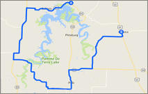
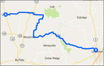
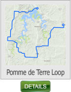
This 43 mile ride takes you from Carsons Corners and circles south around
Pomme de Terre lake, and ending up in Urbana. This is a great short “after
work” ride. Just long enough to unwind the stress of the day.
Pomme de Terre Loop - 43 miles (Missouri)
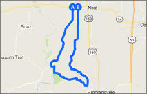
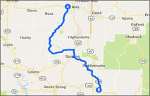
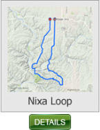
This 19 mile ride is a great ride to unwind to after work. It starts and ends in
Nixa, and is definitely one of those rides you will do over and over again.
Nixa Loop - 19 miles (Missouri)
SHARE WITH US
Copyright © 2026 - Ozark Rides, All Rights Reserved


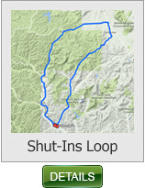
This 50 mile ride loops around and through the Johnson’s Shut-Ins State Park.
Johnson’s Shut-Ins Loop - 50 miles


* Missouri requires all riders UNDER THE AGE OF 26 to wear a DOT approved helmet


Copyright © 2026 - Ozark Rides, All Rights Reserved


43 Miles
86 Miles
81 Miles
45 Miles
19 Miles

35 Miles
37 Miles
Missouri Ride Maps
Page 3


43 Miles
25 Miles
* Missouri requires all riders UNDER THE AGE OF 26 to
wear a DOT approved helmet


MENU